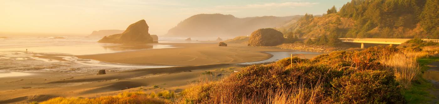
Oregon Coast Hiking Trails
Experience the captivating beauty of Oregon's Pacific coastline with a selection of easy to moderate hiking trails. These paths wind through diverse landscapes, from sandy beaches and rocky headlands to lush coastal forests, each offering its own unique charm. As you traverse these trails, you'll encounter breathtaking ocean views, fascinating tide pools, and picturesque lighthouses that dot the coastline. Whether you're seeking a peaceful sunset stroll along the beach or a moderate cliff-top trek with panoramic views, there's a trail that perfectly suits your adventure spirit. So, lace up your hiking boots, pack your binoculars, and prepare for an unforgettable exploration of Oregon's coastline.
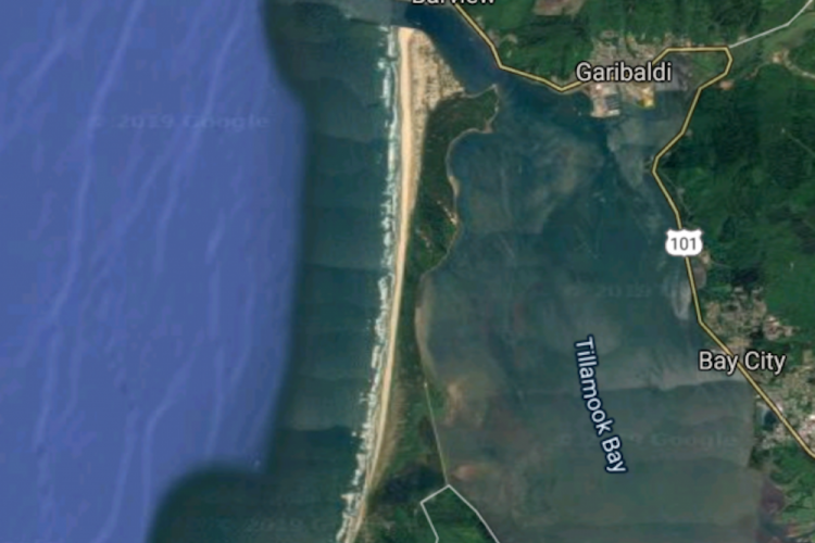
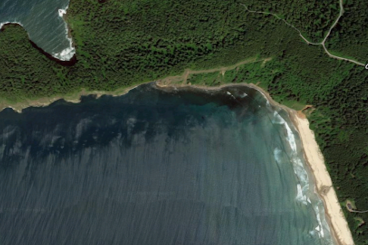
Bayocean Spit Loop Hike
Moderate; Distance: 7.8; Elevation change: 50
Journey through history and nature on the Bayocean Spit Trail, once home to the City of Bay Ocean Park. Begin your hike through the dunes, adorned with Scots broom, evergreen huckleberry, and stunted spruce. As you walk north along the beach, enjoy views of Neahkahnie Mountain, Rock Mountain, and Angora Peak, and keep an eye out for local birdlife. The trail leads you to the end of the spit, where you can watch the swells rolling into the bay.
For the return journey, follow the Dike Road east, passing through shore pine woods and around a small cove. The road then curves around Crab Harbor, offering views of the bay and tidal flats, rich with waterfowl. Finally, take a detour through the Bayocean Townsite, where interpretive signs tell the tale of the lost city. This trail is also suitable for a family bike ride, thanks to its flat terrain and scenic views.
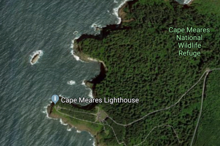
Cape Meares Hike
Moderate; Distance: 5.4; Elevation change: 885
The Cape Meares Trail offers a unique hiking experience along Oregon's coast. Starting at the beach, the trail takes you through varied terrains, leading to the Cape Meares National Wildlife Refuge. As you ascend through the refuge, enjoy stunning views of Bayocean Spit and surrounding mountains. The trail also takes you through dense forests, where you'll encounter Oregon’s largest Sitka spruce, the Big Spruce.
A short walk from the Big Spruce Trailhead leads to the Cape Meares Light Trailhead, home to the small Cape Meares Lighthouse. The trail continues up the cape, passing the unique Octopus Tree. The hike concludes with a return to the Big Spruce Trailhead via the scenic road, and then back to the beach. This hike is best undertaken around low tide.
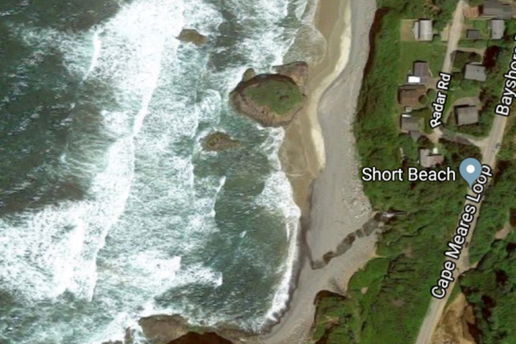
Short Beach Hike
Easy; Distance: 1.4; Elevation change: 95
The Short Beach trail, a local gem, offers a unique coastal hiking experience. Once a treacherous path, it now features a staircase, thanks to the efforts of a local enthusiast. The trail descends through a thicket of spruce and shore pine, leading to Short Creek and the 1,000-yard Short Beach.
The beach is known for its agates, jasper, and zeolites, attracting beachcombers and nature enthusiasts alike. It's also home to prime mussel beds, accessible at low tide. The beach extends to a wave-cut platform, and at low tide, you can continue along a rocky strand to the cliffs of Cape Meares. On your return, enjoy views of Maxwell Point, often dotted with paragliders.
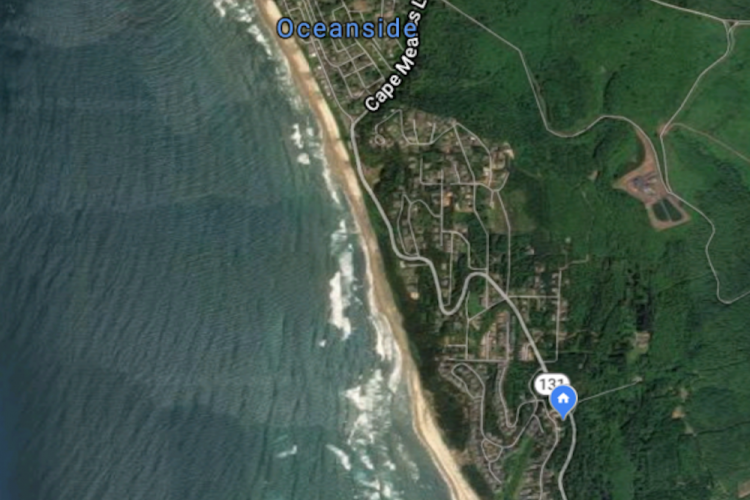
Oceanside to Netarts Hike
Easy; Distance: 6.4; Elevation change: 20
The Oceanside Beach trail offers a dramatic coastal view, featuring the Three Arch Rocks and Maxwell Point. The trail begins at the parking area, leading down to the beach. From here, you can walk north towards the tunnel through Maxwell Point, constructed in 1926, which leads to the secluded Tunnel Beach.
Further along, you can reach Agate Beach at low tide, and even further north, the elusive Lost Boy Cave Beach. Back on Oceanside Beach, the trail leads south, crossing Baughman Creek and passing a shore-pine forested dune.
As you continue, you'll cross Fall Creek and round a point into Netarts Bay, passing the cottages of Happy Camp. The trail concludes at a picnic table above the boat ramp and dock at Netarts boat basin. From here, you can watch crab boats and look for harbor seals before returning the way you came.
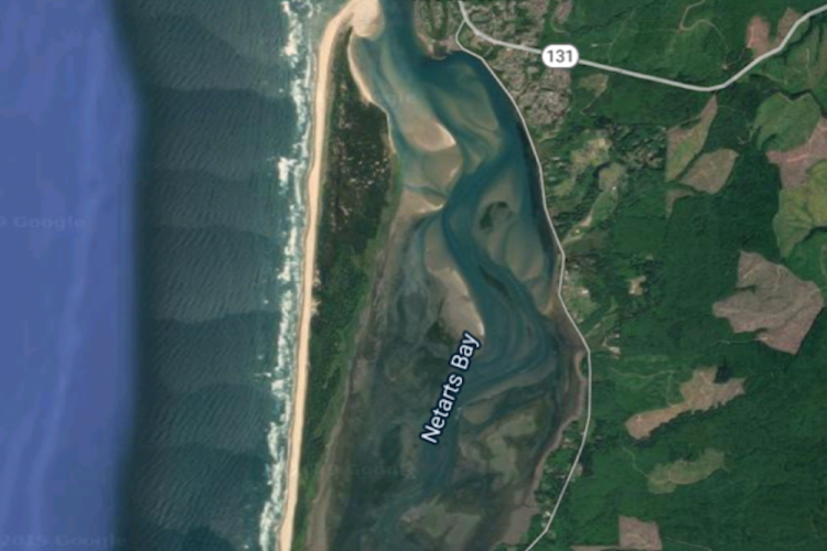
Netarts Spit Hike
Moderate; Distance: 11.2; Elevation change: 60
The Netarts Spit trail is a secluded hike along Oregon's north coast, offering panoramic views from Cape Lookout to Maxwell Point, including the offshore Three Arch Rocks. Starting from a salal/Sitka spruce copse, the trail leads into the heart of the spit, filled with spruce, shore pine, willow, and Scots broom.
The path continues through open grasslands and ascends the dunes, providing expansive views of the surrounding landmarks. On the beach, you'll encounter remnants of a dead forest and a wide sandy expanse at the Netarts Bay Mouth, home to seals and various bird species. The hike concludes with a return along the beach and up to the dunes.
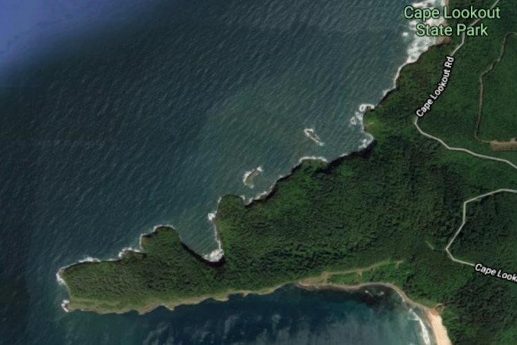
Cape Lookout North Hike
Moderate; Distance: 9.6; Elevation change: 2340
This enticing coastal hike starts from Cape Lookout State Park, winding through a rich forest of Sitka Spruce and western hemlock, and leads to the Cape Lookout Trailhead. Following the trail west, hikers reach a cliff-top viewpoint where, on a clear day, they might spot migrating gray whales, sea lions, and a variety of seabirds.
The path winds through diverse plant life, including salmonberry, sword fern, and evergreen huckleberry. There are several switchbacks to navigate and points of interest such as a WWII memorial. The trail concludes at the cape's tip, offering magnificent views of the surrounding landscape, stretching from Maxwell Point to Cape Meares.
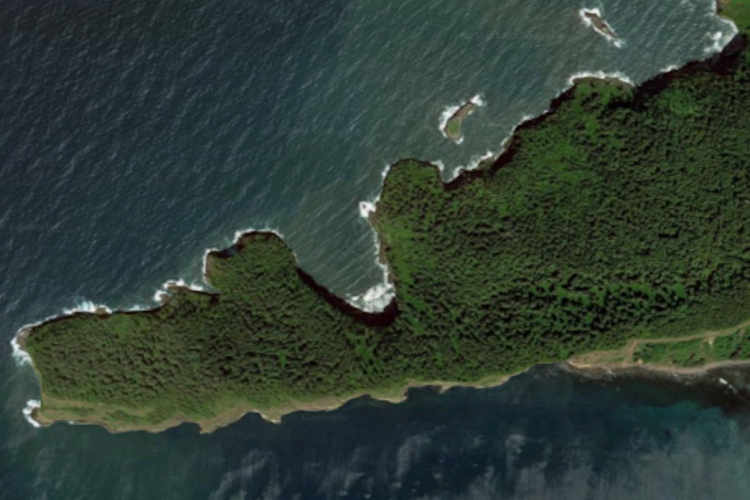
Cape Lookout Hike
Moderate; Distance: 5.0; Elevation change: 930
Cape Lookout offers the best land-based whale watching. Travel through coastal forests from the Cape Lookout Trailhead, leading west through dense undergrowth and muddy paths aided by short boardwalks.
A viewpoint half a mile in offers a southern glimpse of Sand Lake Beach, Cape Kiwanda, and beyond. The trail continues through the forest and along the peninsula, offering views of spruce thickets and leads to a cabled-off viewpoint overlooking the ocean, a hotspot for marine life observation.
Cape Lookout South Hike
Easy; Distance: 3.6; Elevation change: 840
Starting from the trailhead, descend to the South Trail junction and take a left. Journey through forests of young Sitka spruce and sword fern, navigating four extensive and two compact switchbacks.
Cross a babbling creek and take a moment to admire the stunning beach view. Descend via five switchbacks, noting Camp Clark's wooden platforms, before 11 more switchbacks lead you to the beach. Explore the tidal pools before moving towards the cape's cliffs where sand gives way to lava cobbles.
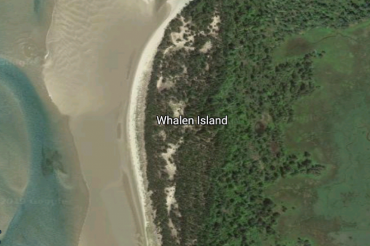
Whalen Island Loop Hike
Easy; Distance: 1.4; Elevation change: 75
The Clay Meyers State Natural Area at Whalen Island, nestled between Cape Kiwanda and Cape Lookout, boasts diverse landscapes, including grasslands, mudflats, beaches, forests, and dunes. An easy loop trail navigates these varying terrains with bird-watching spots, picnic areas, and beach access.
A detour reveals views over the Lillian Parker Craft Wetland, while the main trail winds through vibrant thickets and offers glimpses of the Sand Lake Estuary. Note that noise from a nearby ORV area might be distracting. A viewpoint near a campground trail junction marks the return stretch to the parking area.
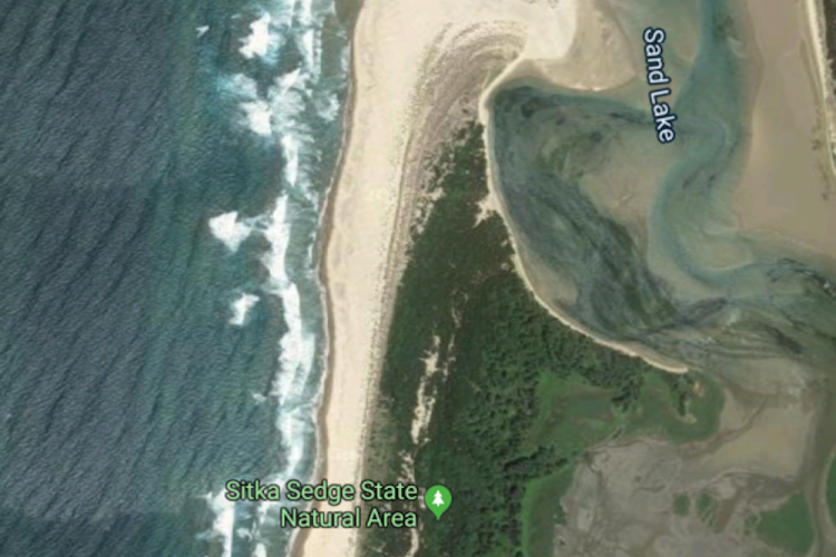
Sitka Sedge Loop Hike
Easy; Distance: 3.9; Elevation change: 80
Sitka Sedge State Natural Area, a 365-acre preserve, hosts wetlands, mudflats, and dunes. Once a grazing farm eyed for a golf course, it now offers diverse trails and beach access. The Beltz Dike Trail starts along a 1920s farm dike, with freshwater wetlands and Sand Lake Estuary views.
The Estuary View Loop leads through woods and sandy slopes with estuary overlooks, bearing seasonal restrictions due to nesting snowy plovers. The Kinnikinnick Woods Loop leads you through spruce thickets and open pine woods, detouring to the grassy Elk Knoll. All trails loop back to the starting point.
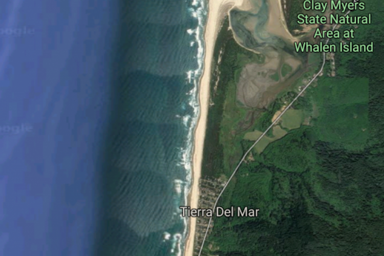
Sand Lake-Cape Kiwanda Hike
Moderate; Distance: 8.2; Elevation change: 240
This beach hike along the Tierra del Mar community offers splendid views of Cape Lookout and Cape Kiwanda. Walk north to the Sand Lake Estuary, and then south to Cape Kiwanda State Park. Remember to stay on wet sand during snowy plover nesting season (March 15th - September 15th).
From the parking area, you'll wander through soft sand, past beach homes and stabilized dune lines. The northern end is a snowy plover nesting area, and the southern boundary is marked by emergency locator number 34B, leading to the Sitka Sedge State Natural Area.
Returning, you'll pass the Cape Kiwanda State Park boundary and walk 1.8 miles on McPhillips Beach. The journey takes you by colorful mudstone cliffs and through Miles Creek Point. At Cape Kiwanda, you can hike up to the Great Dune for panoramic views. If high tide prevents your beach return, use Sandlake Road to return to Tierra del Mar.
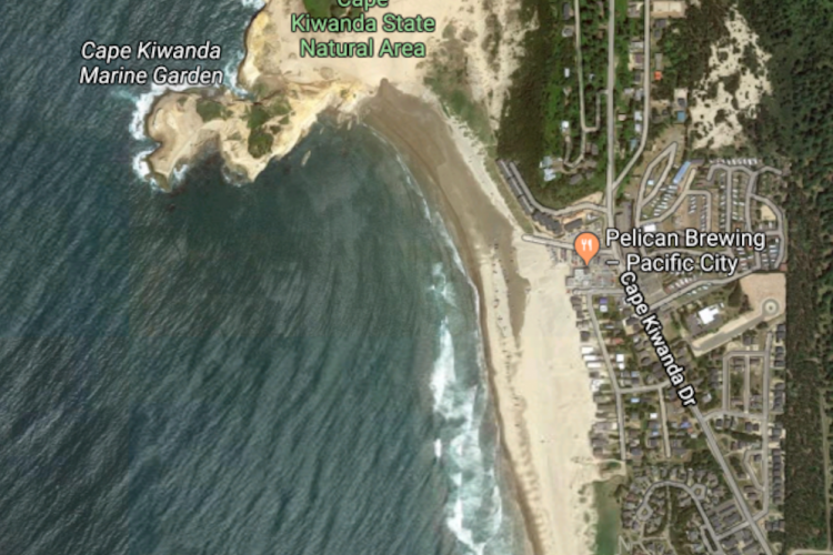
Cape Kiwanda Hike
Easy; Distance: 2.2; Elevation change: 230
Cape Kiwanda offers stunning sandstone formations and views of the headland of Cape Lookout. This walk begins at the Pacific Avenue Trailhead, leading you through dunes to a vehicle-free beach with glimpses of the offshore monolith, Haystack Rock.
As you approach Cape Kiwanda, watch dorymen launch their boats and explore the vibrant sandstone layers at low tide. Follow the fenced trail to the crest of the Cape, providing panoramic views and possible whale sightings. Navigate the sandy slopes to the summit of the Great Dune and finally descend to Kiwanda Beach.
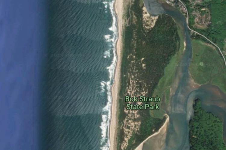
Nestucca Spit Loop Hike
Moderate; Distance: 7.5; Elevation change: 60
Bob Straub State Park, previously known as Nestucca Spit, offers a scenic loop hike from Kiwanda Beach to the Nestucca Bay Mouth, leading into a mossy woodland. Remember, beach accessibility is tide-dependent, and the interior wetland may flood during the rainy season.
Start with beach views of Haystack Rock, Cape Kiwanda, and the Great Dune. As you head south, enter the state park area where you can walk along the dune crest, watching for seals and sanderlings. At low tide, walk along the bayshore beach, or take the inland trail bisecting the spit.
The trail leads you through a woodland of Sitka spruce and shore pine, offering views of Nestucca Bay.